
 |
| Shackleton's dream cover courtesy of the History Press. |
Stephen's book records the story of the Trans Antarctic Expedition (TAE) in the late 1950's whose members consisted both British and New Zealand nationals. It's also a story of the clash of the two personalities who ran the expedition - Britain's Dr Vivian Fuchs and his deputy the fiery New Zealander Ed. Hillary. It's a fascinating story and Stephen helps to bring it all back to life in his book.
We've worked on historical mapping titles previously including (selected examples): The Viking Atlas of WW1, The Viking Atlas of WW2, The Penguin Atlas of D-Day, the DK Factopedia/World Atlas and the Macmillan Atlas of the (American) Civil War.
We were asked to create a selection of bespoke maps to tally with key points in the book. Here's a few low res examples of which below:
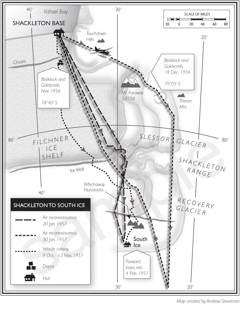


You can see more about this expedition (inc. previously unpublished materials) and get more details on the new "Shackleton's Dream" book on Stephen Haddelsey's blog: http://stephen-haddelsey.blogspot.com/
No comments:
Post a Comment